Posts

Showing posts from October, 2024

Mastering the Start, Center, Angle Arc in AutoCAD: A Complete Guide

Image
  In AutoCAD, precision is key, especially when working with curves and arcs. One powerful method for creating arcs with full control over the curvature is the Start, Center, Angle method. This approach allows you to define an arc by specifying three essential parameters: the start point, the center point, and the angle of the arc. It’s a highly effective technique, especially when you need to draw arcs with a known central angle. In this blog post, we will explore how to use the Start, Center, Angle method in AutoCAD and discuss its applications and benefits. What is the Start, Center, Angle Arc in AutoCAD? The Start, Center, Angle method for creating arcs allows you to specify three key pieces of information: Start Point : The point where the arc begins. Center Point : The center of the circle to which the arc belongs. Angle : The central angle that the arc spans, measured in degrees. This method is useful when you want to create an arc that spans a specific angle from a kno...

How to Draw a Start, Center, End Arc in AutoCAD

Image
  Here’s a step-by-step guide to drawing an arc using the Start, Center, End method in AutoCAD: Start the Arc Command : On the Home tab, under the Draw panel, click the Arc tool, or simply type ARC in the command line and press Enter . Choose the Start, Center, End Option : Once the Arc command is activated, select the Start, Center, End option from the dynamic input or by typing SCE in the command line and pressing Enter . Specify the Start Point : Click on the drawing to place the start point of your arc. This will be where the arc begins. Specify the Center Point : After selecting the start point, click to specify the center point of the arc. This point represents the center of the circle from which the arc is derived. Specify the End Point : Finally, click to place the endpoint of the arc. AutoCAD will then draw the arc segment between the start and end points, based on the circle’s center. Key Benefits of Using the Start, Center, End Arc The Start, Center, End method...

Mastering the 3-Point Arc in AutoCAD: A Beginner’s Guide

Image
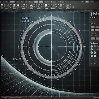
In AutoCAD, drawing arcs is a fundamental task, especially when designing complex shapes or making smooth transitions between lines. One of the most commonly used methods for creating arcs is the 3-Point Arc . As the name suggests, this method allows you to create an arc by specifying three distinct points: the start point, a point along the arc, and the endpoint. It’s a straightforward tool, yet incredibly powerful for various design applications. In this post, we will guide you through the process of using the 3-point arc in AutoCAD and discuss how this tool can benefit your CAD projects. What is the 3-Point Arc in AutoCAD? A 3-point arc is a segment of a circle that is defined by three points. Unlike a full circle, an arc is just a portion of the curve, and using three points to define the arc gives you precise control over the shape and size of the arc. The three points you select in AutoCAD dictate how the arc curves, making this tool highly flexible. How to Draw a 3-Point Arc ...

Calculator

Simple Calculator C DEL / * 7 8 9 - 4 5 6 + 1 2 3 = 0 .

Land Converter Calculator

Land Conversion Calculator Land Conversion Calculator Enter Area: From: Marla Kanal Acre Bigha Square Feet Square Yards To: Marla Kanal Acre Bigha Square Feet Square Yards Convert

How to Measure a Marla in Pakistan: A Comprehensive Guide

Image
In Pakistan, land measurement often uses traditional units such as Marla , especially in residential and agricultural contexts. The size of a Marla can vary depending on the region, which can sometimes cause confusion during property transactions. Below is a step-by-step guide to understanding and measuring Marla in Pakistan. 1. Understanding the Marla Unit A Marla is a traditional unit of area used in Pakistan, India, and Bangladesh, particularly in rural areas or during property dealings. Historically, the size of a Marla was not uniform, leading to regional differences. Over time, two major systems for defining Marla have emerged in Pakistan: Old Marla and Standard (New) Marla . Old Marla (Pre-standardization) The Old Marla is traditionally measured as 272.25 square feet (sq ft). This unit is still used in rural areas and in older property deeds. Standard Marla (Post-standardization) In most urban and planned housing societies in Pakistan, a Marla has been standardized to 225 ...

Understanding the SARSIAI System: A Guide to Traditional Land Measurement in Pakistan

Image
Land measurement is a crucial aspect of land ownership and property management in Pakistan, where it affects agriculture, real estate, construction, and legal transactions. One of the traditional yet prominent methods of land measurement in the country is the "Sarsai" system, a part of Pakistan’s conventional unit system, particularly in rural areas. Despite the advancement of modern digital measurement techniques, the Sarsai method is still widely used and plays a significant role in land-related activities. In this post, we will explore the concept of Sarsai, its conversion to modern measurement units, and its relevance in today’s Pakistan. What is SARSIAI? The term "Sarsai" is derived from the Persian and local traditional system of measuring land. It is a unit of measurement used in South Asia, especially in rural Pakistan and India. A Sarsai is essentially a unit within the broader measurement system that includes other units like Kanal, Marla, and Bigha. Th...